
Bio-degradable cards
Every card imaginable!
|
Bio-degradable cards Every card imaginable! Understanding the Importance of Drone No Fly Zones and How to Avoid Them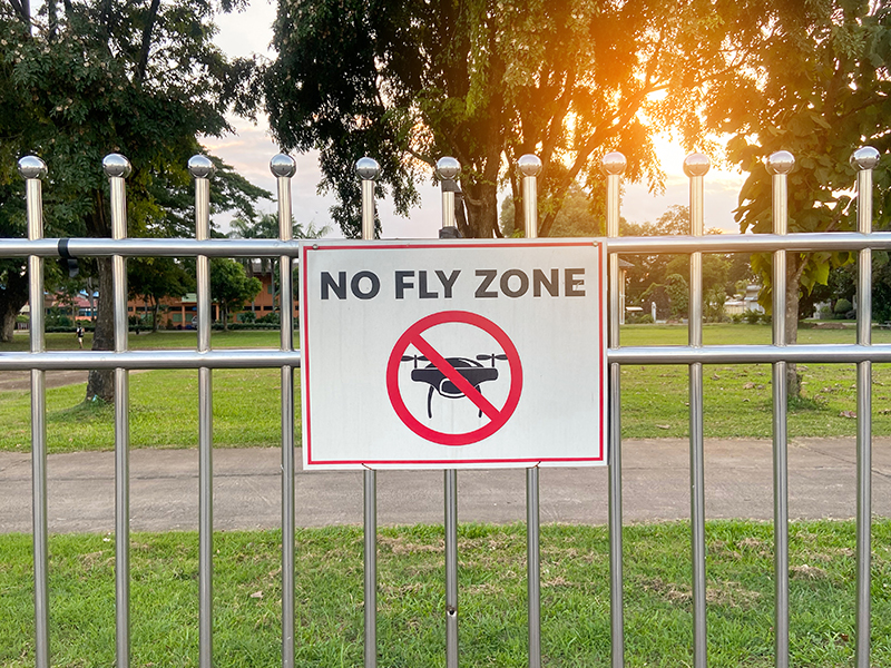
Table of ContentsIntroduction to Drone Flying in the UKDrones have become a popular way for people to capture stunning aerial photos, explore the countryside, or simply enjoy a new hobby. Many families buy them for outdoor fun, and children often love seeing the world from above. But with that freedom comes responsibility. In the UK, certain areas of airspace are off-limits to drones to protect aircraft, people, and sensitive sites. These are known as no fly zones – often called restricted airspace or Flight Restriction Zones (FRZs). Flying in these areas without permission can lead to serious problems. This guide explains what you need to know as of 2026, when some key rules were updated on 1 January. The changes make things clearer and safer as more drones fill the skies. Whether you're just starting out or have been flying for years, the basics remain straightforward: plan ahead, check restrictions, and always put safety first. If you're a parent buying a drone for your child or the family, this information helps you understand the rules from the beginning. Even small drones have limits on where they can go, and knowing them means everyone can enjoy the hobby without worry. The rules apply right across the UK, and the Civil Aviation Authority (CAA) looks after them. By following this guide, you'll stay on the right side of the law and keep your flights safe. 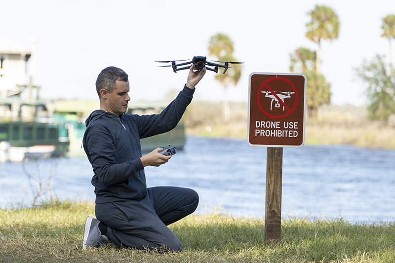
What Are No Fly Zones?No fly zones are specific areas where you’re not allowed to fly a drone, or where flying is heavily restricted and needs special permission. The Civil Aviation Authority (CAA), along with airports and other organisations, creates these zones for clear reasons. They help stop drones from getting in the way of planes or helicopters, protect people’s privacy, and keep secure sites safe from overhead viewing. Put simply, if your drone goes into one of these zones without approval, you’re breaking the law – even if it happens by accident. Most people first come across them when they see big red areas on a map around airports, but they also cover other places like prisons or government buildings. Since the rules updated in 2026, the CAA makes it clear that you should check for no fly zones every single time you plan to fly, regardless of how light or small your drone is. Ignoring this step can quickly turn a fun outing into a stressful situation. Why These Zones Exist in the First Place
Many parents buying a drone for the family are surprised to learn how widespread these zones are. For example, if you live within a few miles of an airport, large parts of your local area might be off-limits. The zones usually start at ground level and go up thousands of feet, so you can’t just fly very low to sneak under them. The key point is that no fly zones aren’t there to spoil your fun – they’re there because the consequences of a mistake can be serious. By understanding what they are and where they are, you can choose safe places to fly and avoid trouble altogether. 
Common Types of Restricted AirspaceThe UK has several types of restricted airspace that every drone pilot needs to know about. These aren't just suggestions – flying in them without permission is against the law and can lead to fines, confiscation of your drone, or even prosecution. The Civil Aviation Authority (CAA) sets most of these rules to keep planes safe, protect sensitive sites, and avoid risks on the ground. As of 2026, the rules remain firm: no drone, no matter how small, can enter these areas without proper approval. Many parents find this surprising when they first check a map and see large red zones near towns or cities. The Main Types You'll Encounter
Some smaller airfields don't have a full FRZ, but you still can't fly close enough to risk endangering planes taking off or landing. The CAA advises staying well clear and contacting the airfield if you're unsure. Other airspace types that affect drones include danger areas (used for military training, like live firing) and high-intensity radio transmission areas (where strong signals could disrupt your drone's controls). These are shown on maps but might allow flight with caution. The easiest way to spot these is by using the official NATS airspace restriction map or a reliable drone app. Many families plan outings around open green areas far from these zones, like countryside parks, to keep things simple and safe. 
Why No Fly Zones MatterFlying a drone in a no fly zone isn’t just breaking a rule – it can create real danger for people in the air and on the ground. These zones exist because the consequences of getting it wrong can be serious, and many parents are surprised to learn just how high the stakes can be. Understanding why these restrictions are in place helps you make better decisions when planning a flight with your family or by yourself. It’s not about spoiling fun; it’s about keeping everyone safe and making sure the hobby stays enjoyable for years to come. Real Risks to Aircraft and Passengers
Protecting People on the Ground
Safeguarding Security and National Interests
Impact on the Wider Aviation System
As a parent or new pilot, think of no fly zones as the same as road rules: you wouldn’t drive through a red light just because you’re in a hurry, because the risk is too great. Checking for restricted areas before you fly is one of the easiest ways to stay safe and responsible. By respecting these zones, you’re not only protecting others – you’re helping keep drone flying a fun, family-friendly activity that can grow without major restrictions. In the next section, we’ll look at the legal requirements you must meet before you even take off. 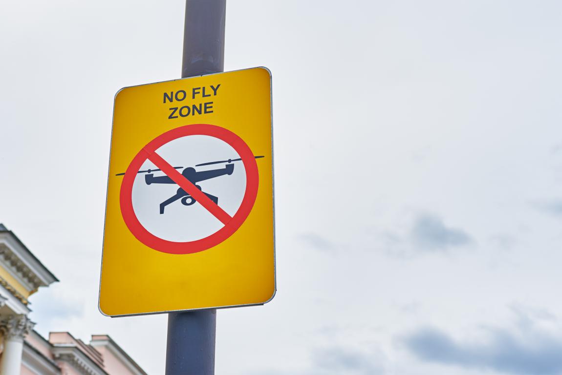
Legal Requirements Before You FlyBefore you take your drone out for its first flight, there are a few legal steps you need to complete. As of 1 January 2026, the Civil Aviation Authority (CAA) lowered some thresholds to make the rules safer and clearer as more people fly drones. These requirements help ensure everyone in the skies knows the basics and can be held accountable if something goes wrong. Most families start with popular small drones that have cameras, so these rules will apply to many new owners. Getting everything sorted is straightforward and done online through the CAA website – it usually takes less than an hour. The Two Main IDs You Might Need
Drones under 100g (often tiny toy ones without cameras) don't require either ID, though the CAA strongly recommends taking the free Flyer ID test anyway to learn the safety basics. If you're a parent, note that children under 18 can get their own Flyer ID, but those under 13 need a parent or guardian present for the test. The parent usually handles the Operator ID. Core Flying Rules Everyone Must FollowThese apply no matter what size your drone is:
Extra Requirement for Night FlyingFrom 2026, if you plan to fly after dark (or in low light), your drone must have a green flashing light switched on and visible from a reasonable distance. Many newer drones have this built-in, but for others, you can buy a small add-on light that clips on. This makes your drone easier for others to spot and distinguishes it from manned aircraft lights. Remember, the light's weight counts towards your drone's total, which might affect which rules apply. Getting your IDs and understanding these rules is the foundation of safe flying. Many parents find the process quick and reassuring – it means you can focus on enjoying time outdoors with the family rather than worrying about breaking the law. Once you're registered, the next step is checking where you can actually fly. We'll cover how to spot no fly zones in the following section. 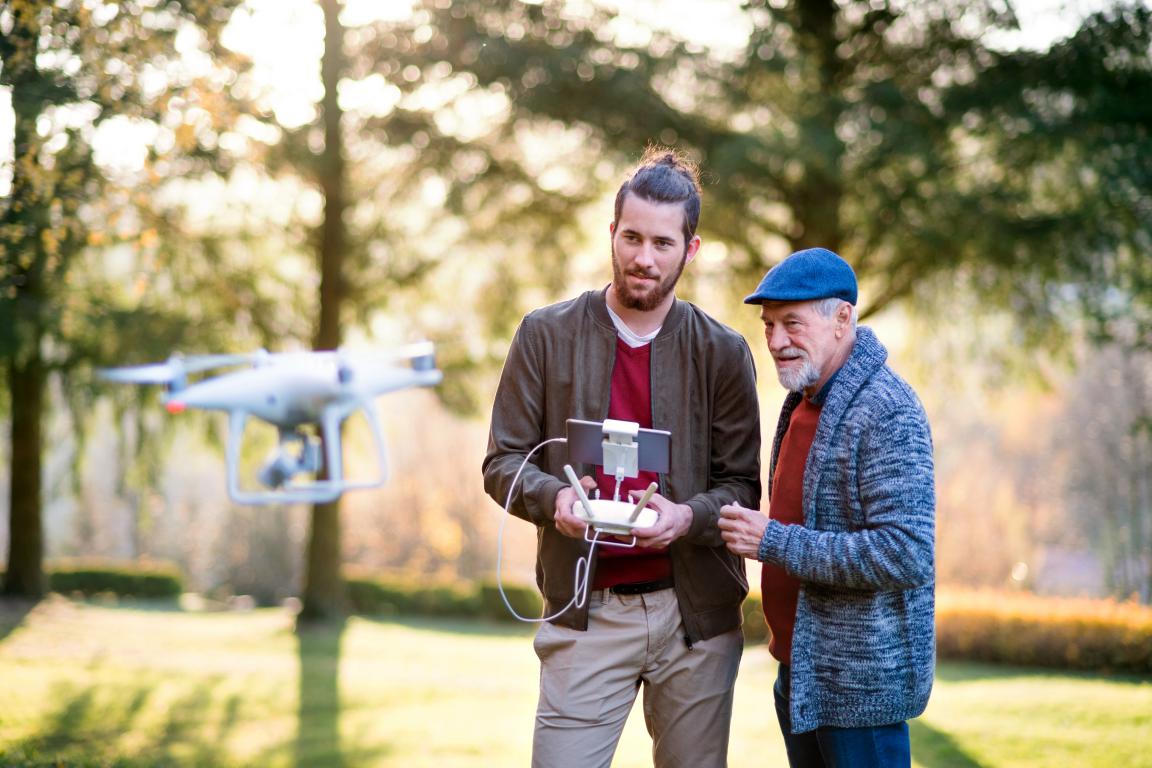
How to Check for No Fly ZonesThe good news is that checking for no fly zones and other restrictions is now easier than ever, thanks to free online tools and apps. As of 2026, the Civil Aviation Authority (CAA) requires you to verify airspace every time you fly, because temporary changes can happen quickly – like for events or emergencies. Skipping this step risks fines or worse. Many parents find it takes just a minute or two once you're familiar with the tools. Start by picking one reliable source and stick with it for consistency. Most Reliable Ways to Check
Handling Temporary RestrictionsTemporary no fly zones often come from NOTAMs (Notices to Air Missions), which announce short-term changes like VIP visits, airshows, or helicopter operations.
Many modern drones from brands like DJI have built-in geo-fencing that alerts you or even stops takeoff in restricted areas. This is a useful backup, but never rely on it alone – manufacturer data might not include the latest temporary changes or local byelaws. The CAA advises using multiple sources if you're unsure, especially near busy areas. By building this quick check into your routine, you'll choose safe spots confidently and keep your flights legal. 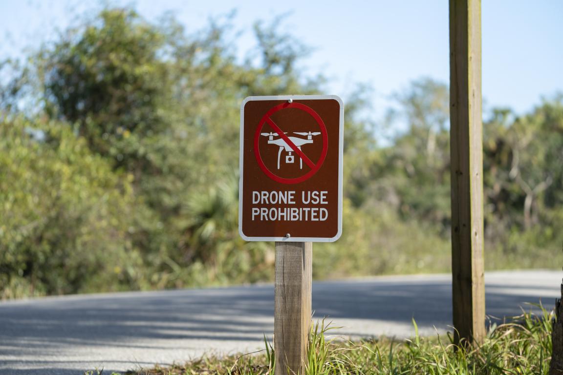
Best Practices for Staying SafeGood planning turns drone flying into a reliable and enjoyable family activity, rather than a rushed one that leads to mistakes. Following a few straightforward habits every time you fly helps you stay well away from no fly zones and keeps risks low. As of 2026, the Civil Aviation Authority (CAA) stresses these steps to make sure everyone – pilots, people on the ground, and aircraft in the sky – stays protected. Many new owners find that building a simple pre-flight routine makes outings more relaxed. Start by treating each flight like a short checklist, even if you're just heading to a local field. Essential Steps Before Every Flight
Everyday Habits for Responsible Flying
If you're ever unsure about a location or rule, contact the local aerodrome or check CAA resources – it's better to ask than guess. Many families also join local drone clubs or online forums for recommendations on proven safe spots near them. These practices aren't complicated, but they make a big difference in avoiding problems. Safe flying means more time enjoying the views and less worry about rules. 
What Happens If You Break the Rules?The Civil Aviation Authority (CAA) and police treat drone rule breaches seriously because even small mistakes can put aircraft, people, or security at risk. Most incidents happen unintentionally – often from not checking airspace properly or misunderstanding the rules – but the consequences can still be significant. Knowing what might happen encourages everyone to double-check before flying. Penalties vary depending on how serious the breach is and whether it was careless or deliberate. The CAA and courts look at factors like the location, potential danger, and if it's a repeat offence. Common Penalties for Different Breaches
Additional Consequences to Consider
The vast majority of drone users never face penalties because they follow the basics: get the right IDs, check maps or apps every time, and stay clear of restricted areas. A quick look at a tool like the NATS map or Drone Assist app before takeoff prevents almost all trouble. If you're a parent or new to drones, talk about these risks with your family – it helps everyone understand why the rules matter. Safe flying keeps the hobby open for all of us. 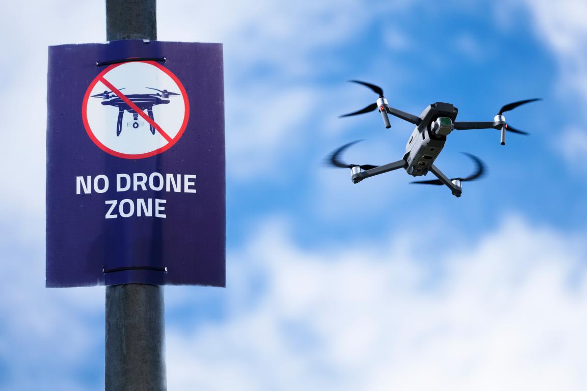
Frequently Asked Questions About Drone No Fly Zones in the UKHere are the most common questions people ask about no fly zones that haven't been fully covered earlier in the guide. These focus on everyday places families might want to fly, like parks, beaches, or national parks. All answers are based on 2026 CAA rules and typical local bylaws. Can I fly a drone in public parks or council-run parks?It depends on the specific park and council. Many UK councils have bylaws that prohibit drones from taking off, landing, or flying in their parks – even if the airspace is clear. Reasons include safety around visitors, noise, wildlife, or privacy. Some councils allow it in designated areas with a permit or small fee, while others ban it completely. Always check the council's website or look for signs at the entrance. Apps like Drone Assist won't show these local rules, so a quick online search for "[council name] drone policy" is essential before you go. Is it allowed to fly drones in national parks like the Peak District, Lake District, or Snowdonia?National parks don't have automatic CAA no fly zones, but most park authorities discourage or restrict drone use on their land. The main concerns are disturbing wildlife (especially during breeding seasons), affecting other visitors' enjoyment, or impacting protected areas like Sites of Special Scientific Interest (SSSIs). Many parks, including those managed by the National Trust or National Park Authorities, require landowner permission for any flight. Some have outright bans or require special permits. Check the specific park's website – for example, the Lake District and Peak District both have clear guidance advising against casual flying. Can I fly my drone on beaches or over the sea?Beaches are often okay for flying if they're not crowded and outside restricted airspace. You must keep at least 50 metres from any uninvolved people and avoid flying over groups. Flying out over the sea is permitted, but be extra careful: strong winds can push your drone away, batteries drain faster in cold air, and if it loses signal or power, it could end up in the water and be lost. Popular beaches might have council restrictions during summer for safety reasons. Always check for local bylaws and fly responsibly to avoid complaints. What about flying near crowds, events, or congested areas?You must never fly over crowds at any height – this includes festivals, sports matches, busy beaches, or outdoor events. The CAA rule requires staying at least 150 metres from large gatherings of people. Even without a formal no fly zone, flying too close or over people is illegal if it risks endangering them. Temporary restrictions often appear via NOTAMs for big events, so check apps beforehand. The safest approach is to find quiet, open spots away from people. Are there restrictions in royal parks (like Hyde Park or Regent's Park) or central London?Yes, many royal parks and central London areas have specific restrictions. For example, parts of London fall under protected zones (like R157–R159) that require special approval for any drone flight. Royal parks often ban drones entirely due to high visitor numbers, wildlife, and security. The City of London and areas around key sites like Buckingham Palace are heavily restricted. Always use a good app to check – these zones can be surprisingly large and are strictly enforced. Can I fly over private property or my neighbour's garden?You can fly over private land if the airspace is unrestricted and you follow height and privacy rules, but you need the landowner's permission to take off or land on their property. Hovering or filming over someone's garden without consent can breach privacy laws (including GDPR) and lead to complaints. It's best to avoid flying near homes altogether – stick to open public spaces or your own land to prevent issues with neighbours. Can I fly near or over a police station?No automatic no fly zone exists specifically for police stations under CAA rules in 2026 – unlike prisons or military bases. You can fly near or over one if the airspace is clear of other restrictions and you follow all standard rules (height limit, line of sight, distances from people). However, police stations are operational sites, so hovering, filming, or getting too close can quickly raise security concerns. Officers might approach you to check your IDs or ask you to land. It's safest to treat them like sensitive areas and keep well clear to avoid any issues. What if my area looks clear on one app but restricted on another?Always cross-check multiple sources. The official NATS map is the gold standard for airspace restrictions, while Drone Assist adds useful extras like ground hazards. Local bylaws or temporary NOTAMs might not appear on every tool. The CAA holds you responsible for accurate checks, so use at least two reliable sources and trust the official one if there's a conflict. A quick double-check can save a lot of issues. If you have more questions, the CAA website and apps like Drone Assist have help sections. Safe flying comes from thorough preparation – these tips should help you pick great spots confidently. Published: 1 January 2026
© 2024 The Card Project Uk Ltd
VAT: 453 2087 06
|